Universities – How They and their Campus Relate to their Urban Setting
ANU – Australia’s National University
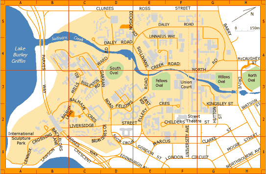
Map of ANU - Source: http://campusmap.anu.edu.au/
Layout of the campus
The layout of the ANU campus is rather spread out, however they are working towards compacting the campus. Urban renewal works are being conducted to ensure development includes a high degree of community rather than promoting social isolation. They are focusing on high density apartments around the University center, rather than low density on the outskirts of the campus.
Relationship and connection to the city
The campus is well connected to Canberra’s CBD, with the walking distance to NorthBourne Avenue (to Childers st) only being only 10min. Due to the University being rather spread out, the walking time does take longer on the far reaches of the campus.
Relationship and connection to the surrounding precinct
The university forms part of City West master plan. The Master Plan states “Few identifiable and attractive pedestrian routes run through City West, and almost no public transport system links City West to East. This is unacceptable, especially for ANU students who should have easy access to the City” (City West Master Plan 2004). ANU is roughly bisected by Sullivans Creek, part of the Murray–Darling basin, and is bordered by the native bushland of Black Mountain, Lake Burley Griffin, the suburb of Turner and the Canberra central business district.
University of Canberra

Map of University of Canberra - Source: http://www.canberra.edu.au/maps/campus-map
Layout of the campus
The University of Canberra is very compact. It fits into one rectangular block. The campus features a large amount of open/unplanned car parks.
Relationship and connection to the city
The University is located on the outer boarder fringe of Canberra. It has very little connection to the CBD, however is connected to the outer suburbs.
Relationship and connection to the surrounding precinct
The campus is surrounded by a lot of unplanned car parking and open space which acts as a barrier between the University and the surrounding community.
Charles Sturt University – Albury
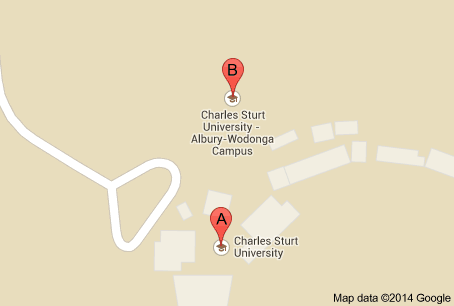
Map of Charles Sturt University - Source: http://goo.gl/maps/Y88lq
Layout of the campus
The campus is spread out over a small area and is rather compact. It is located in the outer suburbs of Albury.
Relationship and connection to the city
The campus is poorly integrated into the city, being 10km from the CBD. The campus is not integrated into the city but into the surrounding developments.
Relationship and connection to the surrounding precinct
The campus forms part of the satellite suburb. It contains its own supermarket and child care facilities. This creates a lack of integration with the city center.
Latrobe – Wodonga
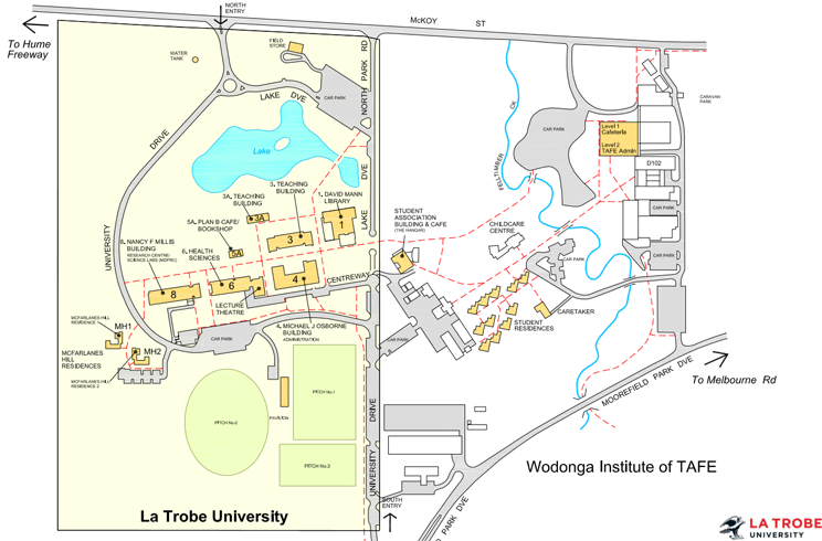
Map of Latrobe - Wodonga Source: http://www.latrobe.edu.au/aw/location
Layout of the campus
The campus is really small, consisting of only 9 building which includes 2 residences. The campus is very linear as all buildings form a single straight line.
Relationship and connection to the city
The campus is located on the outskirts of Wodonga and there is no integration between the campus and the city center.
Relationship and connection to the surrounding precinct
It had very little to no integration into the surrounding precinct. The campus is a Greenfield development on the far outer fringe of Wodonga.